In this section:
Introduction
The Chart operations are commands executed on folders of schema type Chart, located on folders of schema type Charts.
A Geocap Seafloor project can contain several folders with schema type Charts. These folders are normally top folders in the project.
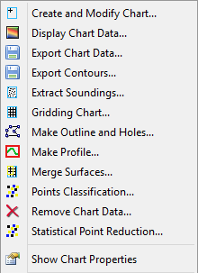
The Charts folder contains several menu items on the right click menu. The tools for charts are located on the top of the menu, and listed in the graphic below. The functionality of each of the tools is described later in this section.
The Charts folder menu
