Getting started with Geocap
- Erlend Kvinnesland
- Anders Moe
- Harald Sund (Unlicensed)
- Tore Sannes (Unlicensed)
Introduction
Geocap is a software for visualization and manipulation of geodata. The core features of Geocap are:
- 2D/3D visualization of any geodata in the same graphics window
- Gridding
- Plotting
- 2D seismic and interpretation
- Geodetic conversion
- Image georeferencing
- Workflows
- GIS
- Scripting
On top of these features Geocap provides a set of plugins that fit perfectly in to your line of work:
- Shelf - for continental shelf delineation in accordance with UN Convention on the Law of the Sea, Article 76.
- Seafloor - for processing survey data from multibeam echo sounders.
- Ground Model - for ground model construction in all stages of project development.
- Oil & Gas and GIM - for oil exploration and reservoir modeling.
Your Geocap installation will consist of the basic Geocap platform and one or several of these plugins.
Exercises:
Start Geocap
Open Geocap from the main Windows Start Menu > All Programs > Geocap.
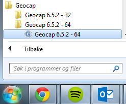
Starting Geocap from the startmenu
User Documentation
Parts of the user documentation is found under the Help pulldown. There rest is found here: http://www.geocap.no/doc. Read briefly through the documentation to get an understanding of what you can expect to find in the documents.
The user documentations consists of:
- User Guide with detailed descriptions of Geocap usage.
- Reference manual with syntax and details of the commands in the Geocap scripting language.
- Installation Guide with details on installation, dongle drivers etc.
- Release Notes contains incremental updates and bug fix descriptions as well as major releases.
- Articles is a collection of articles on various topics that still is not included in the documentation.
- Tutorials contains thematic tutorials on products. The General tutorials mainly contains topics that are put in a better context within the more specialized product tutorials.
- FAQ is a list of Frequently asked questions, with their corresponding answers.
- Geocap Extensions contains different scripts and add-on functionality for Geocap.
The Options dialog
The Options dialog lets you define what Geocap should do on startup. This means that you can predefine a background color, working directory, data window and automatic loading of plugins and scripts etc.
Set your working directory in the Options dialog
- Open the dialog by going to Tools > Options
- Under General, set the Working directory to where your data and project is located.
The Tools > Options dialog can also be used to set the background color in Geocap, load other modules and plugins, change sorting etc.