Drainage areas and orthogonal contours
- Former user (Deleted)
- Erlend Kvinnesland
Introduction
Geocap has a unique and flexible algorithm for generating drainage areas for a terrain. It is much used in migration studies and gives an picture of migration patterns.
Drainage areas are closely connected with orthogonal contours and one sees that the pattern of drainage areas follows the layout of the orthogonal contours.
On this page:
Illustration
To activate drainage areas on a grid terrain: grid > Advanced Display > Drainage areas .
And similar for ortho contours on a terrain: grid > Advanced Display > Ortho contours
Drainage areas and orthogonal contours are illustrated in the terrain image. One sees that the drainage areas follows the ridges and natural drainage pattern of a rain fall. The number of drainage areas are controlled by a minimum size parameter and a requirement of *minimum angle separation<' between adjacent drainage areas.
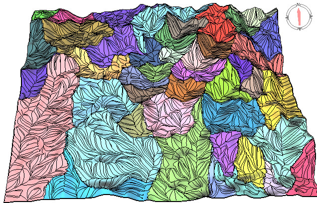
Drainage area and orthogonal contoured
Features of drainage areas
Drainage area calculation and generation
Drainage areas options
- Follows the natural terrain drainage system
- Generation of area border lines
- Minimum size drainage area
- Minimum angle between adjacent areas
- Combine two areas
- Split an area
- Area size calculation