Smoothing a surface, but keeping the tops
Introduction
The task is to smooth a surface, but keeping the tops and ridges. The degree of smoothing is controlled by a gradient value that has not to be surpassed by any part of the terrain.
The application is used for landscape terrains that will be subjected to flight tours by a drone. The tracking path for the drone is taken from the smoothed terrain. The gradient value should not be greater than the capability for the drone to climb upwards when follow the terrain path.
On this page:
Accessing smooth menu
The actual command menu to perform the smoothing is called Smoothing Not Tops. It is not visible for grids by default. One has to to get it from the repository by right click on Schema Commands > New Command.
The gradient displays were produced using the command object grid > Advanced Display > Gradient display.
Example
The terrain below is a typical mountain terrain with tops and valleys. The task was to smooth the terrain to have no gradient higher than 5 degrees and keep all the tops and ridges. The result is shown in a gradient map.
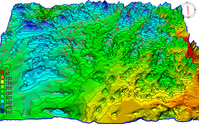
Mountain terrain with tops and valleys
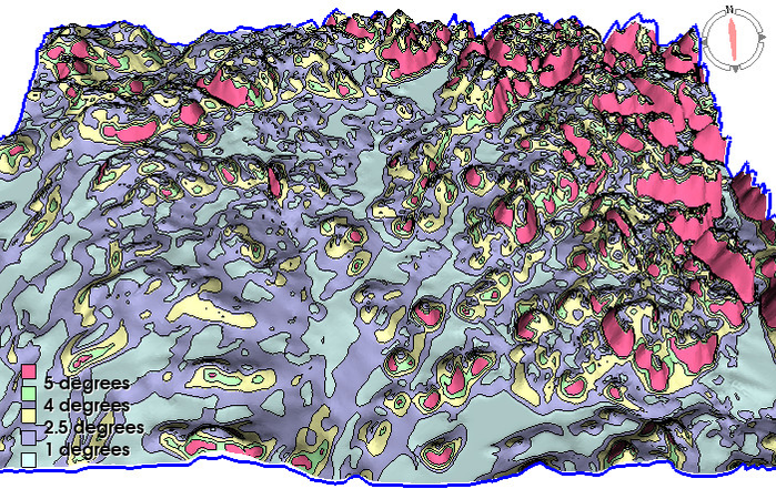
Terrain gradient map before smoothing
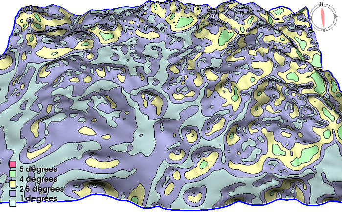
Smoothed terrain with tops intact