Importing Grids
- Erlend Kvinnesland
- Tore Sannes (Unlicensed)
- Former user (Deleted)
Introduction
Make sure you have read the chapter about Importing Data and Generic Import before continuing with this page.
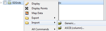
- Import method: Generic
- Import folder type: Generic
Details
After browsing in a grid, Geocap should automatically recognize the format. You will be able to see if Geocap has recognized the format by looking in the File header/information section. It should look somewhat similar to this:

File header information
If the File header/information section is empty Geocap has most likely not recognized the format. In this case you could try to set the format specifically using the Format drop-down box.

Specify format
Geocap will automatically set the Schema to Structured Points, but you can also set this specifically (e.g. to Seabed surface) using the Schema drop-down box.
Make sure the Import as Grid radio button is ticked in the Reader Options tab.
Some grids has negative values for sea depths, and positive values for heights above sea level. Usually most bathymetry data has positive values for depths. The generic import therefore has an option to multiply the depth and height values with -1. This option is Invert Z and can be found under the Reader Options tab.
Importing parts of a grid
The Area of Interest tab lets you import parts of a grid.

Import area selection
The File Range is the outline of the grid you are browsing in, while the Import Area lets you type in min and max values in X and Y direction.