V. PostScript Plotting
V. PostScript Plotting
- Harald Sund (Unlicensed)
- Tore Sannes (Unlicensed)
- Erlend Kvinnesland
Owned by Harald Sund (Unlicensed)
Last updated: Oct 21, 2015 by Tore Sannes (Unlicensed)
Introduction
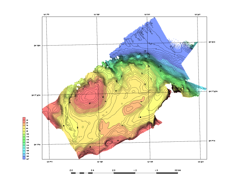
Geocap has a plotting system utilizing the PostScript language. The plotting system enables you to create scaled maps containing axes, scale bars, contour maps, lines, points, legends and anything else you might need.
Note that you will have to install Ghostview and Ghostscript in order to make the plotting system work.
Exercises
Open and run a saveset in the plotting system
Exercise
Open and run a saveset in the plotting system
- To open the PostScript plotting panel go to *Tools > PostScript Plotting.
- Click File > Read saveset.
- Browse for the saveset in the plotting folder under the Seafloor_Training project on your disk.
- Click Generate Draft.
- When asked if you want to overwrite existing plot, click Continue.
- When the plotting has finished click File > View Plot in Ghostview.
Ghostview should pop up and show your plot.
Explore the different plotting options
Exercise
Explore the different plotting options
- Try clicking on the different check boxes to open the settings menu for each option.
- Try to change some values and re-run the plot to see the changes.
, multiple selections available,
Related content
The SEG-Y Scanner
The SEG-Y Scanner
More like this
Seismic Interpretation
Seismic Interpretation
More like this
Publishing seismic data using Ground Model and Seismic Server
Publishing seismic data using Ground Model and Seismic Server
More like this
Ground Model Viewer
Ground Model Viewer
More like this
Importing Seismic Data
Importing Seismic Data
More like this
Seismic Explorer for ArcGIS
Seismic Explorer for ArcGIS
More like this